 Maps are 22" x 34" and cover each half-section of the county. Map can be purchased at the Western Service Center in Apple Valley.
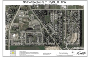
Pictured map shows a current color aerial photo, overlaid with property lines.
View and download maps through the
map catalog. FTP client access is available at ftps://maps.co.dakota.mn.us/HalfSection.
Maps include the following layers that can be turned on and off
after downloading:
- Air photo
- Property lines
- Property line dimensions
- Street centerlines
- Plat boundaries
- Contours (1’)
- Property addresses
- Planimetric layers
- Building footprints
- Sidewalks, trails, curbs and driveways
- Street centerlines
- Plat boundaries
- Physical features (tree lines, street lights, etc.)
Cost:
Please refer to the pricing list for associated fees.
For more information about PDF layers, go to the
Adobe website.