Overlooking a broad valley carved by glacial meltwater about 12,000 years ago where the Mississippi and Minnesota rivers meet, Pilot Knob was a well known landmark used by river boat captains to navigate the lower portions of the Minnesota River.
It later became the namesake for the current major north-south road in the county. However, well before Europeans began exploring and settling the region, the area including the hill was a sacred gathering place for Native American people. It was named Oheyawahe, "a hill much visited," by the Dakota people centuries ago.
The site holds historical significance. It was also the site where the Dakota people signed a treaty ceding 35 million acres, including most of the southern portion of the state, to the U.S. government. It was also suggested as the location for the new Minnesota Territory capitol. Oheyawahe/ Pilot Knob was listed on the National Register of Historic Places in 2017.
In 2002, developers planned to build 157 townhomes on the north slope of the area, between Acacia Park Cemetery and Highway 55. A broad coalition of Native Americans, local residents, historians, archaeologists, faith communities and environmental groups united to preserve the land as a public natural area.
In 2006, the City of Mendota Heights, with diverse funding assistance, including $400,000 from the County, purchased 8.2 acres from the developer. In 2007, the City acquired another 17.2 acres from Acacia Park Cemetery, with an additional $400,000 from the County.
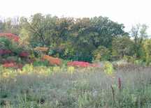
The City contracted with Great River Greening, a non-profit conservation organization, to restore the former prairie and oak savanna plant communities. A small parking area and an unpaved trail lead to the Seven (Dakota) Council Fires Overlook, where the Minneapolis and St. Paul downtown skylines are visible. A new landscape plan has been developed which includes a future pedestrian trail connection to the adjacent Big Rivers Regional Trail.